STORMS Model
The Strategies and Tools for Resilience of buried infrastructure to Meteorological Shocks project, or STORMS for short, was a Building a Secure and Resilient World’ (BSRW) funded project. The project used an open-source framework called SynxFlow. Read on to find out more about the model produced from this project from the creator’s viewpoint.
Description of the model
SynxFlow is an open-source, GPU-accelerated multi-hazard simulation framework designed for high-performance modelling of floods, landslides, and debris flows. It integrates seamlessly with Python-based workflows and can work with other data-driven or hydrological models (e.g., rainfall-runoff or forecasting systems) as part of a larger hazard analysis pipeline.
What does the model do
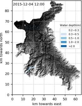
It numerically solves shallow-water and related flow equations to simulate flood inundation, landslide runout, and debris flow dynamics over complex terrain. SynxFlow supports multi-GPU parallelism, rapid computation at high spatial resolution, and automated input/output processing for geospatial data.
Why was the model made
The model was created to overcome limitations of existing GPU-based hazard simulators—particularly their single-hazard focus, limited scalability, and dependence on vendor-specific GPU frameworks such as NVIDIA CUDA. SynxFlow addresses these issues through a hardware-agnostic design, with migration toward SYCL/oneAPI to support NVIDIA, Intel, and AMD GPUs. It aims to provide an open, flexible, and hardware-independent tool that bridges research, practical risk assessment, and real-time forecasting needs.
What was envisioned for the model
Our team envisioned SynxFlow as a next-generation hazard modelling platform—fast, modular, and user-friendly—capable of integrating with modern data science tools, cloud/HPC systems, and even AI-driven automation for scenario analysis.
How is the model intended to be used
SynxFlow is intended for flood and landslide risk assessment, real-time hazard forecasting, infrastructure and urban resilience planning, insurance and financial risk analysis, and research or education in natural hazard processes. It can also be applied to evaluate climate change impacts on natural hazards and to support the development of adaptation and mitigation strategies.