IMPACT Model

The Improving flood disruPted road networks with a dynamic people-Centric digital Twin project, or IMPACT for short, was a Building a Secure and Resilient World’ (BSRW) funded project. Read on to find out more about the model produced from this project from the creator’s viewpoint.
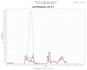
A histogram demonstrating traffic flow analysis on London Underground. Image taken from the DAFNI Platform.
Description of the model
The Dynamic Flood-Induced Traffic Congestion Risk Assessment Platform is a digital twin system that assesses how flooding impacts urban transportation networks and traffic congestion patterns in real-time. The model operates as a standalone tool and can also be integrated into broader disaster management workflows.
What does the model do
The model integrates road network data, commuter behaviour patterns, and flood maps through a four-layer methodology (data context, computation, integration, and evaluation). It calculates context-based betweenness centrality to identify critical road segments, applies dynamic exposure flagging based on flood-grid intersections, and generates time-variant vulnerability indices and congestion risk maps. The platform tracks which road segments become impassable as flooding progresses and predicts where traffic bottlenecks will emerge throughout the flood event.
Why was the model made
Current approaches to flood-related traffic management rely on static network assessments that fail to capture the dynamic evolution of flood impacts on transportation systems. A critical gap exists in integrating real-time flood modelling with temporal network measurements. This model was developed to address this gap by providing dynamic, data-driven insights into how traffic disruptions cascade through urban networks during flooding events, enabling proactive emergency response and infrastructure planning.
What was envisioned for the model
We envisioned a comprehensive decision-support tool that bridges the gap between flood modelling and transportation analysis. The platform empowers transportation authorities, emergency responders, and urban planners to understand and anticipate congestion risks as flood conditions evolve, supporting real-time intervention strategies and long-term resilience planning. By combining topological network analysis with transportation system dynamics, we aimed to create a holistic approach that captures both physical infrastructure vulnerabilities and functional traffic performance.
How is the model intended to be used
The platform is intended for multiple applications:
- Real-time emergency response planning and resource allocation during flood events
- Infrastructure vulnerability assessment to identify critical road segments requiring protective measures
- Long-term urban resilience planning and climate adaptation strategies
- Evidence-based policy development for flood risk management
- Training and scenario testing for transportation management authorities
Contact:
Qiuchen Lu, Xuhui Lin, qiuchen.lu@ucl.ac.uk, zczlxl3@ucl.ac.uk